Below you will find pages that utilize the taxonomy term “Transit”
November 12, 2011
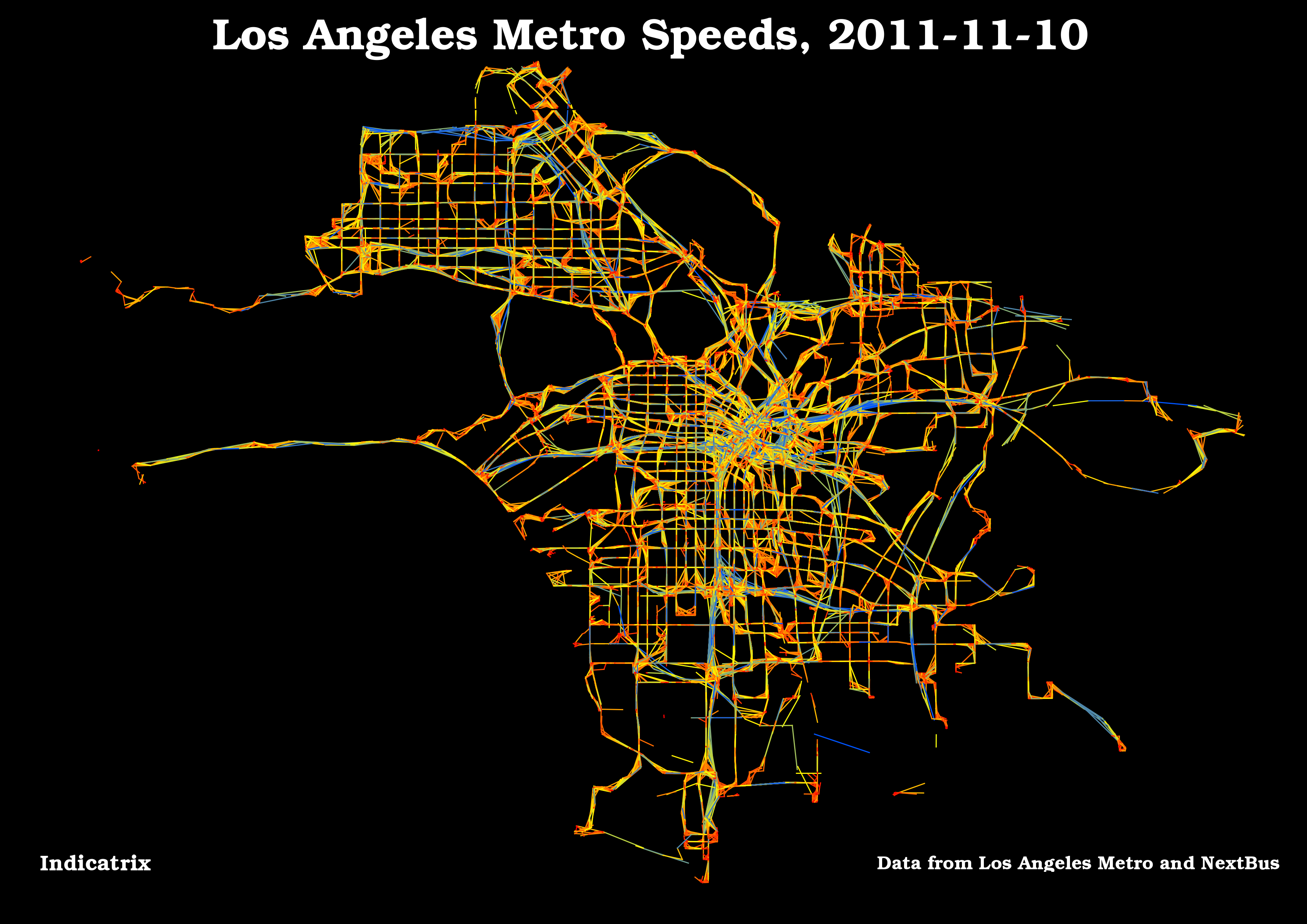
Another LA Metro Visualization
Here’s another visualization of the data used in the previous post; I made the lines a lot finer, so the noise is less visible. It’s easier than ever to see the Silver Line. I classed the data manually this time.
November 12, 2011
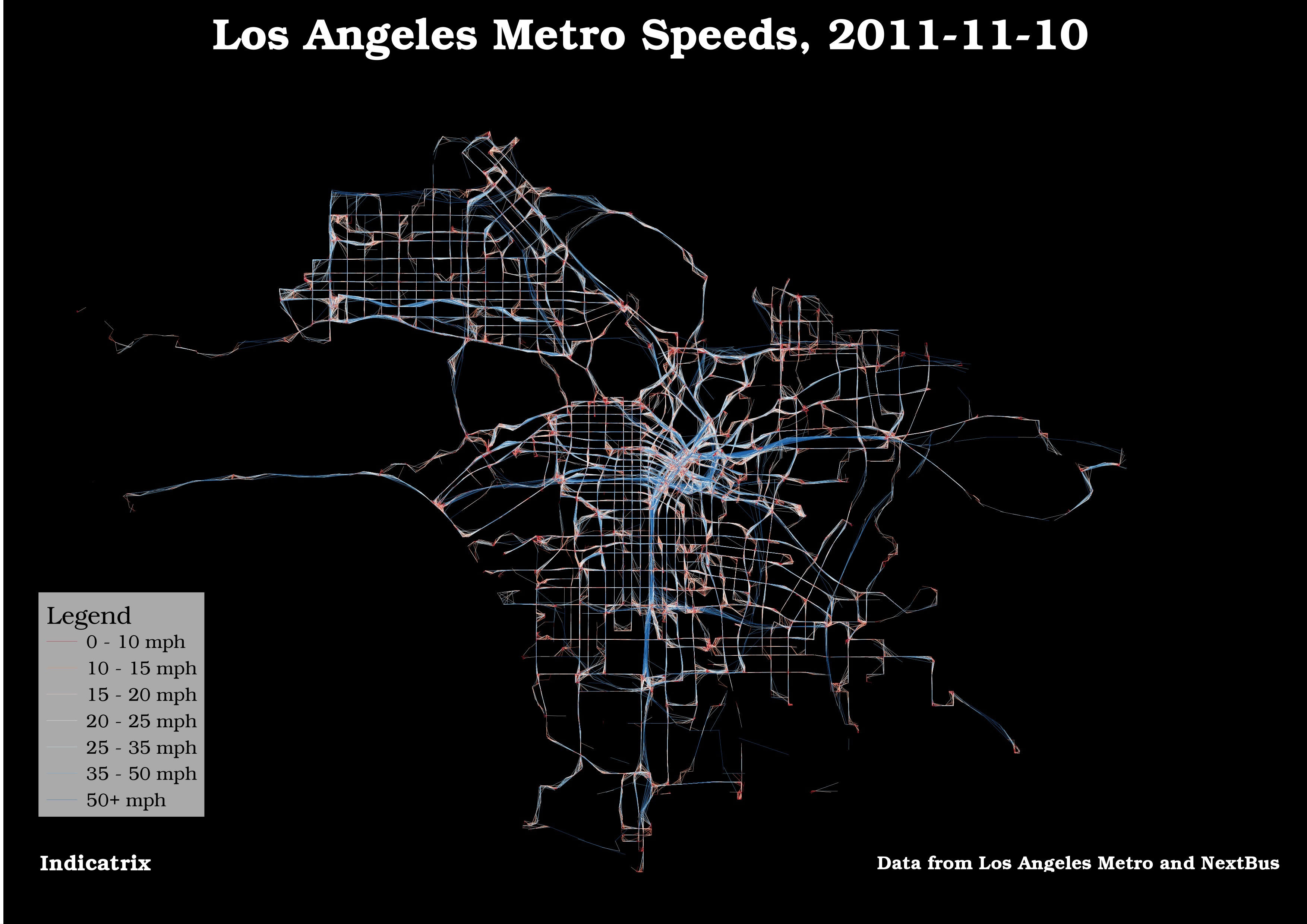
Making Transit Travel Speed Maps with Open Source GIS
Update 2011-11-12 8:21 -0800: I just posted a visualization I like better.
The Internet has been abuzz the past week regarding transit speed maps. It seems to have been spurred by a post on Bostongraphy, which was inspired by many of the amazing visualizations produced by Eric Fischer, especially this one. Indeed, this blog has gotten a fair bit of traffic itself, because Andy Woodruff of Bostonography used my avl2postgis project to retrieve the data.
July 11, 2011
Transit Appliance at OSCON
If any of this blog’s readers will be attending OSCON July 25-29th in Portland, I suggest you check out the session being led by my codeveloper, Chris Smith, leader and founder of the Transit Appliance project, citizen activist and blogger extraordinaire. He’ll be talking about the open-source roots of the Transit Appliance project, and how the use of open data, hardware and software allows us to create arrival displays that are “disruptively low cost.” More information is available on the official page for the talk.
May 29, 2011
Archiving Historical Data from NextBus
It seems that everyone who analyzes historical NextBus data has a different way of archiving their data. There are lots of ways one can use GIS to analyze this data, from creating movies showing the pulse of the transit system, to analyzing on-time performance, to finding bottlenecks. In that vein, I’ve created a short Python script that fetches NextBus data and puts it into a PostGIS database for analysis. You can download the latest version here. Here’s a rundown on options:
April 2, 2011
Agencies Providing Real-Time Data
As a part of the Transit Appliance Project, I’ve been evaluating what transit agencies have real-time data; here’s a (non-exhaustive) list, focused primarily on U.S. agencies (note: these are only agencies that provide an API, not any agency with a real-time feed):
- TriMet, Portland, OR, custom JSON\[-P\] feed, XML may also be available. GTFS-realtime is also available.
- San Francisco Muni, via NextBus.
- Bay Area Rapid Transit (BART), San Francisco, CA, custom XML feed. Their Google Group is very responsive and helpful. GTFS-realtime is also available.
- AC Transit, Oakland, CA, via NextBus.
- Los Angeles Metro, both via NextBus and a custom XML API.
- Unitrans, Davis, CA, via NextBus. Their GTFS is hosted by Sacramento RT.
- MBTA, via NextBus. They have a GTFS at http://www.eot.state.ma.us/developers/ that has stop ids to match NextBus. They have a trial up for rail arrivals.
- Transport for London (TfL), custom XML API.
- Washington Metropolitan Area Transit Authority (WMATA), custom XML/JSON\[-P\] API; has real time arrivals for rail, but only positions for buses (no arrivals).
- DC Circulator, via NextBus. I couldn’t find any public GTFS.
- Chicago CTA, custom XML API for buses, no arrival data for trains yet.
I know that there are a ton that aren’t on here; as I do more research, I’ll put more up.